

http://web.mac.com/rv8apilot/iWeb/Trip%20Pictures/Carlsbad%20.html
 Click on the link above to go to more pictures from the Carlsbad trip. We picked New Mexico to visit because it had the best weather in the country. But wouldn't you know it, the weather turned stinky just in time for our return to Memphis. As you can see on the Garmin, the weather around Dallas and south of there was nasty. Fortunately, we were able to deviate to the north and avoid any significant weather, although our IFR skills were required.
Click on the link above to go to more pictures from the Carlsbad trip. We picked New Mexico to visit because it had the best weather in the country. But wouldn't you know it, the weather turned stinky just in time for our return to Memphis. As you can see on the Garmin, the weather around Dallas and south of there was nasty. Fortunately, we were able to deviate to the north and avoid any significant weather, although our IFR skills were required.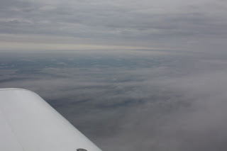
So, we left Carlsbad mid morning, and landed in Oklahoma City at Sundance airport about two and a half hours later. After a delicious lunch consisting of crackers and a diet coke, we were back in the air enroute to Memphis.


 Just for the heck of it, we flew a practice ILS approach back into Carlsbad. Everything in Romeo Victor is working just fine.
 t an hour drive from the Holiday Inn Express in Carlsbad to the visitor's center at Guadalupe Mountains National Parks just across the state border in northwest Texas. Despite being about 3,500 feet above sea level, the terrain around Carlsbad is pretty flat until you get to the mountains to the south and west. The hiking trails in this area offer anything you want, from short and flat to steep, long and rocky. We chose two short hikes for the day. The first was called Devil's Hall and was 4.2 miles round trip. This was a moderately intense hike and included a bit of scrambling across rocks.


